You are reading: drone rules for Ireland
Drone rules Ireland · Updated 2026
Flying a drone in Ireland: rules for residents and visitors in 2026
Ireland applies the EU drone regulation: residents register with the Irish Aviation Authority (IAA) through MySRS, and registrations and certificates from other EU countries are valid. The open category needs no authorisation. Restrictions come from the IAA’s geographical zones – especially the height limits around airports – and from a ban at all Office of Public Works heritage sites, including Skellig Michael and Brú na Bóinne. For recreational flights with drones under 20 kg, insurance is not mandatory, but the IAA recommends it.
- IAA registration via MySRS
- Height limits near airports
- No flying at OPW sites
AI-generated image
Status: legal position as of 2026, based on Regulation (EU) 2019/947, the pages of the Irish Aviation Authority (IAA) including its zone dataset of 6 November 2026, and the rules of the Office of Public Works. Editorial information, not legal advice.
120 m
maximum height
82
zones in the IAA dataset
30 m
typical limit in amber airport areas
90 m
limit in green airport areas
20 kg
insurance required from here (recreational)
The IAA’s zones are clearly documented but they change: for major events such as St Patrick’s Day the authority sets up temporary restricted areas [6], and in 2026 it established a permanent zone over Cork [7]. The IAA shows its interactive map for reference only; the zone dataset, NOTAMs and temporary restricted areas are decisive [3]. Separately, EASA proposed in September 2026 to require registration and Remote ID from 100 g – not yet law [11]. In detail: what the EASA 100-gram threshold would change.
The essentials in 20 seconds
Residents register with the IAA via MySRS; registrations and certificates from any EU country are valid in all EASA states [2], [5].
The open category needs no IAA authorisation [5].
Red areas: specific category only; amber: mostly 30 m; green: 90 m [4].
Drones are prohibited at all Office of Public Works heritage sites [8], [9].
Mandatory except for recreational flights under 20 kg; the IAA recommends it for everyone [5].
Night flights are allowed if the drone shows a green flashing light visible from all sides [5].
EU law and Irish rules: what applies where?
Implementing Regulation (EU) 2019/947 applies in Ireland. In the open category you fly within visual line of sight, no higher than 120 m above the ground and never over assemblies of people [1], [6]. Registrations and certificates are valid in all EASA states [2]. Residents of Ireland register through the IAA’s MySRS portal, which also verifies name and age [5].
The competent body is the Irish Aviation Authority (IAA). It publishes the geographical zones as a dataset in the common European format and as an interactive map [3], [12]. Depending on the location, the zone authority is AirNav Ireland, the Defence Forces, the Irish Prison Service, An Garda Síochána or a government department [4].
| Topic | Rule in Ireland | Basis |
|---|---|---|
| Operator | Register via MySRS (or in your EU country of residence); operator number on every drone | EU 2019/947, IAA |
| Remote pilot | A1/A3 or A2 from any EASA state | EU 2019/947 |
| Zones | 82 zones in the IAA dataset of 6 Nov 2026 | IAA |
| Airports | Red: specific category only; amber mostly 30 m; green 90 m | IAA dataset |
| OPW sites | Drones prohibited | Office of Public Works |
| Insurance | Mandatory except recreational under 20 kg | IAA FAQ |
| Night | With a green flashing light | IAA FAQ |
Sources: IAA [3], [4], [5], Office of Public Works [8].
Getting started with a drone in Ireland
Visitors already registered in another EU country do not need a second registration. The effort lies in choosing your take-off point: airports, monuments and events have their own rules [4], [8].
Carry your A1/A3 proof or A2 certificate; both are valid in all EASA states [2].
Look up your take-off point on the IAA map and check NOTAMs and temporary restricted areas before every flight [3], [12].
In amber and green airport areas, set the height limit in your drone app [4].
If the site is in the care of the OPW, the drone stays on the ground [8].
If you fly after sunset, you need a green flashing light [5].
Your operator number must be visible on every drone. One option is a 20 × 8 mm aluminium plate, laser-engraved with your operator number without the three secret characters. According to the seller it is made for light drones such as the DJI Mini series or Neo.

Zones and map
The IAA zone dataset of 6 November 2026 contains 82 zones [4]. Most are around airports and airfields. There are also sensitive sites where you must request access from the zone authority – such as prisons, barracks, military ranges, Phoenix Park in Dublin, the Aviva Stadium or Midleton Distillery [4]. For military zones, allow at least three working days [4].
The IAA provides the zones as a GeoJSON file and as an interactive map; according to the IAA, the map is for reference only [3], [12].
Zones may overlap; the IAA advises clicking through all information boxes of a zone [3].
For events such as St Patrick’s Day the IAA sets up temporary restricted areas that require explicit permission [6].
In 2026 the IAA established a permanent zone over Cork for beyond-visual-line-of-sight flights; ordinary VLOS flights need no extra coordination there [7].
Airports and control zones
Around airports with a control zone – Dublin, Cork, Shannon, Kerry, Knock (Connaught), Waterford, Sligo and Donegal – the IAA divides the area into coloured sections [4]. In red areas, only the specific category with air traffic control approval is possible. In amber areas the limit is usually 30 m – or the height of the tallest obstacle within 50 m, plus up to 15 m. In green areas you may fly up to 90 m [4].
| Area | What applies | Examples |
|---|---|---|
| Red | Specific category only, with approval | Dublin, Cork, Shannon, Kerry |
| Amber | 30 m (Donegal, Sligo, Kerry: 15 m), over obstacles up to 15 m above them | Dublin, Cork, Shannon, Waterford |
| Green | 90 m; above that specific category only | Dublin, Cork, Shannon, Sligo |
| Terrain areas | Specific category only | Dublin, Cork, Shannon |
Source: IAA, UAS zone dataset of 6 Nov 2026 [4]. Simplified overview; the details of each zone are decisive.
Monuments, nature and privacy
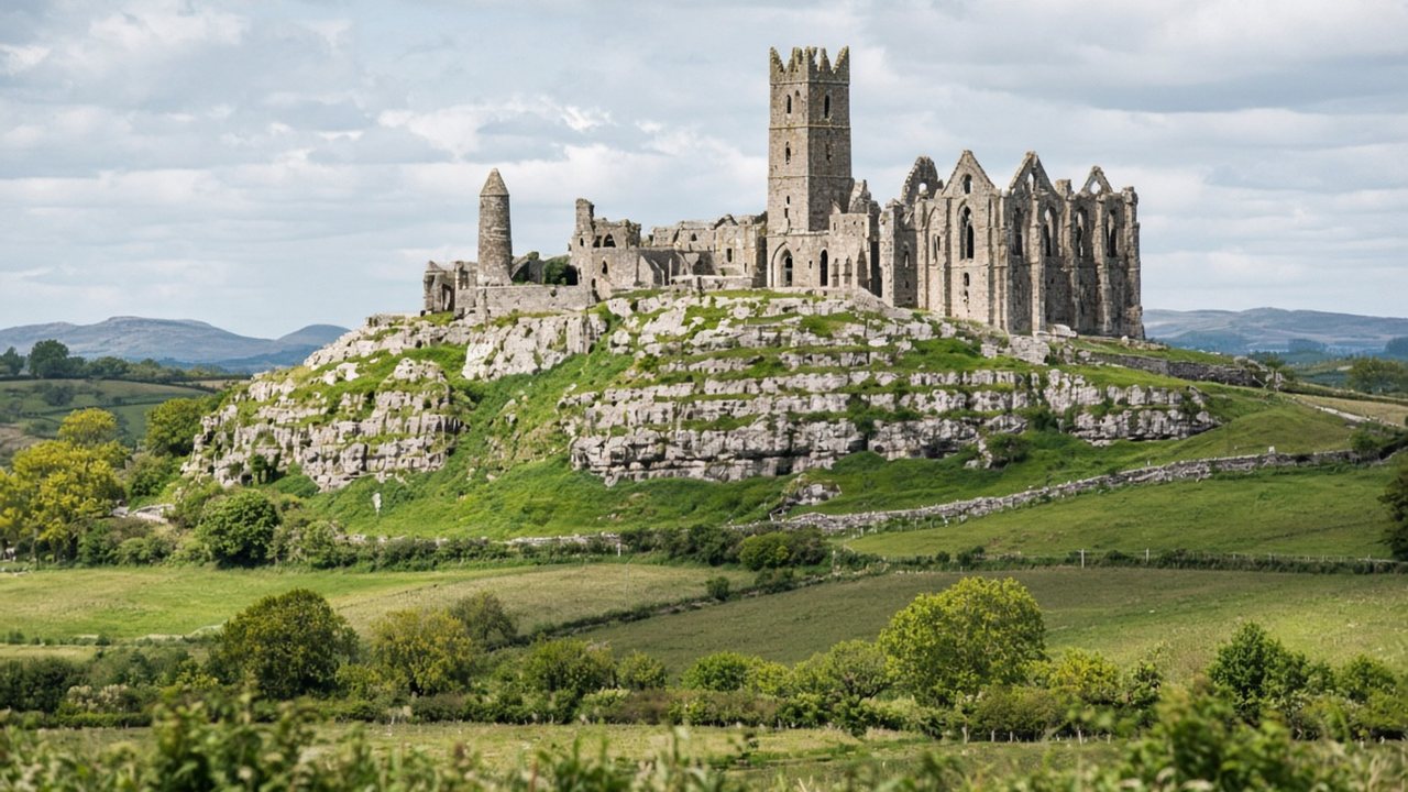
The Office of Public Works (OPW) looks after many of Ireland’s best-known castles, monasteries and prehistoric sites. Its rules are clear: the use of drones is prohibited at all OPW heritage sites [8]. The OPW publicly repeated this ban at the end of 2025 [9]. For protected nature areas, the IAA refers to a separate map from the environmental authorities [3].

- Section “Drone Filming”.
- “The use of UAVs/drones is prohibited at all OPW Heritage sites.”
Source: Office of Public Works, heritageireland.ie · screenshot of 18 Nov 2026 · markings: drohnen.de
The IAA points out that its rules apply everywhere in Irish airspace and that privacy or trespass law may also be relevant; the Data Protection Commission has published its own guidance on drones [5], [10].
Insurance, minimum age and night flying
According to the IAA, operators always need insurance – except for recreational flights with drones under 20 kg. The IAA still recommends it for everyone [5].
According to the IAA, Irish aviation regulation sets no minimum age for flying; only people over 16 can register, and parents can register for younger children [5].
Allowed if the drone shows its position from all sides with a green flashing light [5].
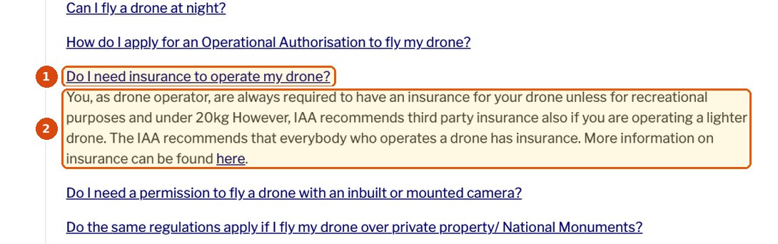
- Question: Do I need insurance to operate my drone?
- Mandatory except for recreational flights under 20 kg; the IAA recommends third-party insurance for everyone.
Source: Irish Aviation Authority, iaa.ie · screenshot of 18 Nov 2026 · markings: drohnen.de
Common mistakes
Many famous ruins are OPW sites where drones are prohibited [8].
The city lies in the control zone; amber areas usually have a 30 m limit [4].
Temporary restricted areas apply at major events [6].
No night flight without a green flashing light [5].
Ireland from above: cliffs, monuments and the Wild Atlantic Way
Ireland’s best-known sights lie along the Atlantic coast and inland: sea cliffs, the south-western peninsulas, monastic islands such as Skellig Michael [13] and Neolithic tombs such as Brú na Bóinne [14].
For drone pilots this means: many famous monuments are Office of Public Works sites, where drones are prohibited [8]. Around airports and at sensitive locations, the Irish Aviation Authority’s zones apply [3].
Places worth seeing – and what to check
West coastCliffs on the Wild Atlantic Way
High sea cliffs above the Atlantic, often busy at the viewpoints.
Drone check: Many underestimate wind and gusts at the edge; never fly over groups of visitors and check the zone map first [3].
County KerrySkellig Michael
Rocky island with an early Christian monastery, World Heritage [13].
Drone check: The site is in the care of the Office of Public Works; drones are prohibited at OPW sites [8].
County MeathBrú na Bóinne
The passage tombs of Newgrange, Knowth and Dowth, World Heritage [14].
Drone check: OPW site: drone flights prohibited [8].
DublinDublin and Phoenix Park
The capital on the Liffey with its bridges, port and large city park.
Drone check: The city lies in the airport’s control zone with red, amber and green areas; Phoenix Park is a zone of its own [3].
Where the drone stays on the ground
Drones are prohibited at all Office of Public Works heritage sites, including many well-known castles, monasteries and tombs [8].
In the red areas of control zones only specific-category operations with approval are possible [3].
Prisons, barracks, ranges and major events have their own zones; flights only on application [3].
Videos: EU rules and Ireland from above
The first video is from our own YouTube channel and in German; turn on subtitles and choose “Auto-translate” for English. Channel names, dates and running times are taken from the YouTube pages. We cannot verify whether the landscape film was shot with permission, and it does not show where you may fly today.
EU Drohnenverordnung – Änderungen ab 2024 für alle Drohnen und Drohnenklassen
Our own explainer on the end of the EU transition period on 1 January 2024: legacy drones under and over 250 g, classes C0, C1 and C2, and why registration and certificates are valid across the EU. Ireland’s zones are not covered.
The video only loads from YouTube after you click (privacy-enhanced mode). Watch on YouTube
Ireland 4K – Scenic Relaxation Film With Calming Music
A calm landscape film set to music, without narration; according to its description it includes the Skellig Islands and the Cliffs of Moher. The film does not say where or with which permission the footage was shot.
The video only loads from YouTube after you click (privacy-enhanced mode). Watch on YouTube
Frequently asked questions about drones in Ireland
How do I register as a drone operator in Ireland?
Through the IAA’s MySRS portal if you live in Ireland. You must be over 16; parents can register for younger children. The registration is valid in all EASA states.
Can visitors fly a drone in Ireland?
Yes. With a registration and certificate from another EU country you may fly in the open category. Check the IAA zones before every flight.
Can I fly in Dublin?
Only outside red areas and restricted zones, and only up to the height limit of each area – usually 30 m in amber areas and 90 m in green areas. Phoenix Park is a separate zone that requires access approval.
Can I fly at the Cliffs of Moher or on the Wild Atlantic Way?
Outside zones and OPW sites, the normal EU rules apply. Check the zone map, keep away from visitors and allow for the often strong wind.
Can I fly over Skellig Michael or Newgrange?
No. Both are in the care of the Office of Public Works, and drones are prohibited at all OPW heritage sites.
Do I need insurance?
Not for recreational flights with drones under 20 kg, although the IAA recommends it. For other flights it is mandatory.
Can I fly at night?
Yes, if the drone has a green flashing light visible from all sides.
Is there a minimum age?
According to the IAA, Irish aviation regulation sets no minimum age for flying, but you must be over 16 to register as an operator.
Where can I get binding information?
From the Irish Aviation Authority on zones and rules, from the relevant zone authority for access approvals and from the Office of Public Works for heritage sites.
Conclusion: Ireland is doable – with an eye on airport zones and monuments
Registration and certificate are enough; the open category needs no authorisation. The IAA’s zones are well documented, but the height limits around airports are strict.
If you skip OPW heritage sites, respect the coloured airport areas and watch for temporary restrictions at events, you can show cliffs, coasts and landscapes from the air legally.
Share
Who is flying a drone in Ireland?
Send this guide to anyone planning to fly in Ireland.
TransparencySources and dataprimary sources first
- EUR-Lex: Implementing Regulation (EU) 2019/947 (legal text), accessed 18 Nov 2026.
- EASA: Travelling with drones (EU agency), accessed 18 Nov 2026.
- Irish Aviation Authority: UAS Geographical Zones (authority), accessed 18 Nov 2026.
- Irish Aviation Authority: Ireland UAS Geographical Zones (GeoJSON), issued 06.11.2026 (dataset), accessed 18 Nov 2026.
- Irish Aviation Authority: Safety & Regulations – FAQs (authority), accessed 18 Nov 2026.
- Irish Aviation Authority: Fly Smart, Fly Safe this St Patrick’s Day (authority), 13.03.2026, accessed 18 Nov 2026.
- Irish Aviation Authority: Irish Aviation Authority to establish long-term drone safety zone over Cork City following consultation (authority), 13.05.2026, accessed 18 Nov 2026.
- Office of Public Works: Filming and Photography (authority), accessed 18 Nov 2026.
- Longford Leader: Drones and metal detectors strictly prohibited at Irish heritage sites – OPW (news report), 23.01.2026, accessed 18 Nov 2026.
- Data Protection Commission: Guidance on the use of drones (authority), accessed 18 Nov 2026.
- EASA: Opinion No 06/2026 (EU agency), 18.09.2026, proposal without legal effect.
- Irish Aviation Authority: UAS Geographical Zones Ireland – interactive map (map application), accessed 18 Nov 2026.
- UNESCO: Sceilg Mhichíl (World Heritage listing), accessed 18 Nov 2026.
- UNESCO: Brú na Bóinne – Archaeological Ensemble of the Bend of the Boyne (World Heritage listing), accessed 18 Nov 2026.
NotesDisclaimer and transparency
Note: This article provides general information on drone law in Ireland. It does not replace legal advice or binding information from the Irish Aviation Authority, zone authorities, the Office of Public Works or your insurer. The authorities’ information, the current zone dataset and NOTAMs before each flight are decisive. Last editorial review of the legal position: 18 Nov 2026.
Transparency: This article was researched and written with AI assistance and checked by our editors. All photos are AI-generated illustrations; they do not imply permission to fly at the places shown. The screenshots come from heritageireland.ie and iaa.ie; the markings were added by us. The Amazon link is an affiliate link: if you buy through it, drohnen.de earns a commission. Your price does not change, and Amazon takes you to your local store.
Uncertainties: The table of airport areas simplifies the IAA zone dataset; individual zones have different limits. According to the IAA, its interactive map is for reference only. Check heritageireland.ie to see which monuments are OPW sites.
Transparency and editorial note: in line with the transparency requirements of Article 50 of the EU AI Act, which apply since 2 August 2026, our articles are checked, put into context and approved by our editors before publication. Final assessment and editorial responsibility rest with our editorial team.
Besides our own and supplied photos, we use illustrative images. These may be created or edited with digital tools. Where legal transparency or labelling duties apply to individual content, it is marked accordingly.

